BALTIMORE — Clear skies overnight. Watch out for patchy black ice as melting snow refreezes overnight.
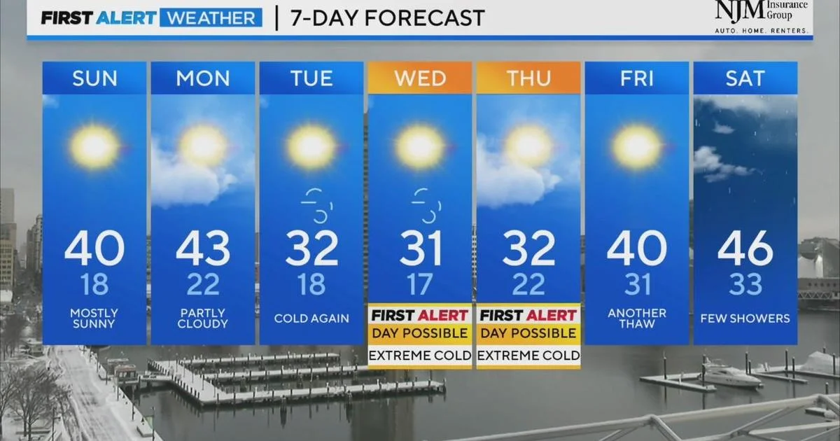
We added one to three inches of snow to the snowpack Saturday morning. We will see some melting the next several days with afternoon highs near 40 to 45 degrees. Much of the snow will stick around as we will only see a couple of days of warmer afternoons before a polar blast Wednesday and Thursday.
For the rest of the weekend, expect lots of sunshine. High temperatures will reach near 40 degrees on Sunday afternoon. The warming trend will continue into Monday, with highs in the low 40s. We do expect overnight temperatures to dip into the 20s overnight Saturday into Sunday and then again Sunday night into Monday. This will allow snowmelt to refreeze. Expect hazardous driving conditions overnight as the snowmelt continues.
Another arctic cold front will move through the area by Tuesday, dropping high temperatures back into the 30s. Overnight lows will dip into the mid-teens Tuesday and Wednesday nights. Highs on Wednesday will struggle to reach the upper 20s to around 30 degrees.
Wind chills will drop into the single digits Wednesday and Thursday mornings. As a result, we have issued a possible alert day for both days due to the low wind chills.