CLEVELAND, Ohio — A fast-moving clipper storm from Canada will move into Northeast Ohio on Thursday and could drop up to 5 inches of snow on much of the region.
According to forecasts from AccuWeather, the storm is expected to produce 1 to 3 inches of snow from the Midwest to the Great Lakes and central Appalachians. Some narrow bands could bring 6 inches of snow.
The National Weather Service has issued a winter weather advisory, which will take effect at 4 a.m. Thursday and remain in effect until 4 a.m. Friday. The advisory includes Cuyahoga, Lorain, Lake, Geauga, Ashtabula, Medina, Summit, Portage, Trumbull, Wayne, Stark and Mahoning counties.
The Weather Service says the storm will impact travel as roads and bridges are expected to become slick. Both the morning and evening commutes could be impacted Thursday.
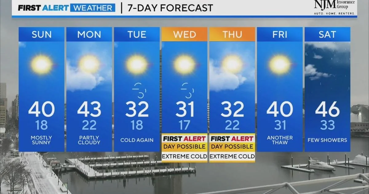
Thursday’s high will be around 30 degrees but strong winds will make it feel much colder. Overnight temperatures will be in the mid-20s.
An even colder system arrives over the weekend and will send temperatures plummeting. The predicted high for Monday is 7 degrees and the overnight low will be around minus-3. Tuesday’s predicted high is 6 degrees.